Mapping for Sites and Areas of Significance to Māori (SASM) clarified
Published on 05 August 2022
We understand some in our community have questions over the Wāhi Tūpuna areas (also known as Sites and Areas of Significance to Māori) that have been mapped in the Draft District Plan. If you would like to know more about what this mapping is for, and what impact it might have for you if it affects your land, then please read on.
What does the mapping mean?
''It is a matter of national importance, under the Resource Management Act, to recognise and provide for the relationship of Māori and their culture and traditions with their ancestral lands, water, sites, wāhi tapu (sacred sites or areas), and other taoka (treasured possessions, whether material or abstract)'', said David Campbell, the Heritage and Planning manager at Waitaki District Council. Sites and areas of significance to Māori require protection from adverse effects of subdivision, land use and development.
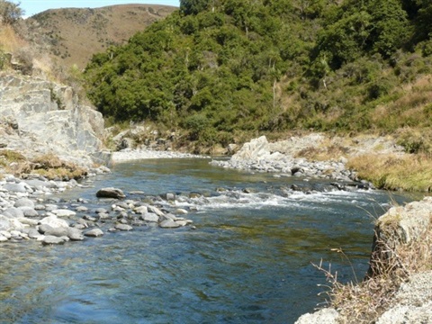
So put simply, the mapping is to recognise or acknowledge the Māori history of the Waitaki district. Kāi Tahu whānui have travelled, lived and used resources in the Waitaki District and have historical and cultural connections with land, waterbodies and resources across the district. Their whakapapa (genealogy and cultural identity) and traditions are embedded in the landscape.
In urban areas (such as the General Residential Zone or Settlement Zone), if you are proposing a new building or structure and it is permitted in your zone, there are no additional rules arising from the Wāhi Tūpuna mapping. For Wāhi Tūpuna outside of urban areas, provided new buildings are appropriately set back from waterbodies, wetlands, ridgelines and limestone escarpments and meet a couple of standards around height and footprint size (a maximum of 6 metres in height and 200m² in area), the building would not require a consent under the rules of the Sites and Areas of Significance to Māori chapter. We appreciate that many landowners are already respectful of these features across our district when siting new homes or buildings.
In Wāhi Tūpuna areas, all zones are subject to limits around the clearance of indigenous vegetation. Typically, clearance activities are permitted within a Wāhi Tūpuna area when being done for maintenance and repair of existing and lawfully established infrastructure systems such as tracks and driveways, yards, fences, stock water systems and dams. Outside of such maintenance and repair, a resource consent would be required. And when a resource consent is required, a written approval or notification to Te Rūnanga o Moeraki would likely be needed.
Earthworks activities are also managed by rules in Wāhi Tūpuna areas across both urban and rural zones. In the General Rural and Rural Lifestyle zones, earthworks are permitted when undertaken for maintenance and repair of existing and lawfully established tracks, driveways, yards and the like. This limiting of earthworks to repair and maintenance purposes, mirrors the limits for earthworks in landscapes recognised as being sensitive for some other reason, such as being highly valued for its scenic values, its ecosystems or when in proximity to a listed heritage item. Beyond these permitted maintenance related situations, a resource consent would be required.
Earthworks in a Residential or Settlement zone with a Wāhi Tūpuna area overlay are not subject to any new rules over and above the new general standards for earthworks activities that are being suggested by the draft Earthworks Chapter. These general standards in the Earthworks chapter apply whether inside or outside of a Wāhi Tūpuna area.
It is important to note that while the Draft District Plan would permit Mahika kai activities (customary gathering of food and natural materials) this does not override the need for landowner permission to be obtained to access private property.
Currently, the Operative District Plan has no policies, rules or mapping for significant sites or areas and relies solely on ensuring rūnanga are consulted by applicants when mana whenua values may be affected. However, there are no triggers to alert property owners and plan users to when these circumstances might arise. The mapping of sites and areas of significance to Māori in the Draft Plan should provide more certainty for everyone as to when effects on cultural values need to be given some thought.
Do you agree with this? Give Us Your Feedback:
Listen to the Video Below: