Medium Density Residential Zones Identified
Published on 13 June 2022
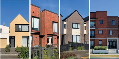
Under the Draft District Plan, people will have more choices when they build a house. People have said that’s what they want. We have got plenty of residential land in most of our towns. In some parts of Ōamaru that are closer to the town centre or local centres, the Draft District Plan would allow for more houses to be built on sections. In these medium density areas, there’s also a possibility that multi-storey units could be built, so we’d like to know if you support this.
Some questions have been raised about Council’s response to the National Policy Statement on Urban Development (NPS-UD) in the Draft District Plan. If you would like to know more about the requirements of the NPS-UD, then please read on.
Urban Development Policy Requirements
The NPS-UD requires councils to plan for growth and create ‘well-functioning urban environments’ for all people, communities and future generations – this means ensuring that people can live close to jobs, community services, public transport, and other amenities.
Ōamaru is identified under the NPS-UD as a ‘Tier 3 urban environment’ and Waitaki District Council is a ‘Tier 3 local authority’. The NPS-UD requires tier 3 local authorities, to enable more housing that meets the needs of the community - through infill, more dense housing and through identifying new areas of land. The NPS-UD only directs that intensification be enabled (not required) through district plans, e.g., the district plan may provide for increased heights as a permitted activity but that doesn’t mean that someone must build to that height.
There are more directive parts of the NPS-UD that apply only to Tier 1 local authorities (e.g. Christchurch City Council), and others that only apply to Tier 1 and 2 local authorities (e.g. Christchurch City Council and Dunedin City Council). However, key objectives and policies in the NPS-UD that direct how intensification must be provided for in all tiers, including Ōamaru, are outlined below.
Objective 3: Regional policy statements and district plans enable more people to live in, and more businesses and community services to be located in, areas of an urban environment in which one or more of the following apply:
- the area is in or near a centre zone or other area with many employment opportunities
- the area is well-serviced by existing or planned public transport
- there is high demand for housing or for business land in the area, relative to other areas within the urban environment.
Policy 5: Regional policy statements and district plans applying to tier 2, and 3 urban environments enable heights and density of urban form commensurate with the greater of:
-
the level of accessibility by existing or planned active or public transport to a range of commercial activities and community services;
-
or relative demand for housing and business use in that location.
Council's Response to National Policy Statement
Based on the policy direction in the NPS-UD, intensification in Ōamaru must be enabled, through the district plan, in accordance with the level of accessibility, or demand. As part of preparing the final version of the Spatial Plan, and particularly given the extensive community feedback on intensification, Council took a closer look at accessibility and demand to make sure we have identified the right areas to allow for intensification. This includes the following areas:
- in or within close proximity to the Ōamaru town centre, or any other area that provides employment opportunities, commercial services and community activities, for example North Ōamaru
-
areas with high accessibility by active or public transport. Active transport includes walking and we have identified areas within a 10min walk of the town centre, where people work or access services and facilities (see pages 40 – 43 of the Ōamaru, Weston and Kakanui Spatial Plan)
-
areas with high demand – this includes areas with high land values, areas near the town centre, near schools, areas close to open space or areas with good outlooks/views, for example the Ōamaru town centre, surrounds and South Hill (see pages 40 – 43 of the Spatial Plan)
In these locations, Council must enable heights and densities that are aligned with the level of accessibility or demand. This means that in areas which are highly accessible in terms of what is walkable to the town centre or commercial or community activities or there is high demand, then a corresponding level of intensification must be enabled.
The 12m height being recommended in the Medium Density Zone is reflective of both the high accessibility levels and demand in these areas – this does not mean however that any new house has to be built to 12m nor would it be always easy or desirable to do so.
Any new building would also need to comply with the ‘height in relation to boundary’ recession plane standards. The recession plane applies at the boundary between properties and is used to stop new buildings from dominating and shading over neighbouring properties. The recession plane requirements in the Draft District Plan have not changed from the current district plan. This means that while the maximum height has been increased would be 12m, in many cases a 12m high building would be impossible to build on the typical sized lot found in Oamaru without a resource consent. For such applications, written approvals are often required from adjoining neighbours. This means that larger, more intensive residential activities would be encouraged to utilise larger sites where any effects on neighbouring landowners would be reduced. Additional standards proposed include the requirement to provide side yards, landscaped areas, minimum outdoor living spaces and a maximum building coverage. These standards will ensure a sense of openness is retained throughout existing residential areas.
The Draft District Plan also recommends that new ’multi-unit developments‘- which means development with more than three new dwellings on a site and could include apartment buildings, would all require resource consent. This would allow Council the opportunity to closely assess the impacts on neighbouring properties, such as shading and privacy.
Oamaru’s South Hill is one of three areas that meets the NPS-UD criteria as being suitable for greater intensification, due to its proximity to the town centre and the demand the area experiences and has been identified as a Medium Density Residential area in the Spatial Plan. Council recognises that through the Spatial Plan process it emerged that the South Hill area is highly valued by the community as a character housing area. In response to this, we will be undertaking an assessment of the character and/ or heritage values across the South Hill area to get a better understanding of the values present. We can then determine whether the values are sufficiently high enough to be what the NPS-UD terms ‘qualifying matters’ and whether that then impacts the standards for development in the zone, such as building coverage, boundary setbacks and height. This assessment will be undertaken before the Proposed District Plan is notified.
We would welcome your feedback: