Draft District Plan Mapping
To find out what is allowed to happen on a piece of land refer to the Draft District Plan Maps on our website, locate the property and identify the zone it is located in.
As well as the zones, you should also check for any ‘overlays’. An overlay identifies distinctive values, risks (such as a floodplain) or other factors that may require management in a different way to the underlying zone. Each zone and overlay has its own chapter containing the objectives, policies and rules.
Objective: the goal or outcome – what we want to achieve through our District Plan
Policy: sets out and indicates how we will achieve our goal or outcomes
Rule: identifies whether a consent is required and sets the standards that need to be complied with for an activity e.g. the hours you can operate your business or the height you can build your house
How to use the Draft District Plan Mapping
You can access our Draft District Plan mapping tool via the link below:
PLEASE NOTE: For the best display results it is recommended to view the Draft District Plan maps on a computer. When viewed on a mobile or tablet device the mapping will only operate with a simple map viewer and basic navigation tools. Please visit our information centre in Ōamaru or join us at one of our district-wide drop-in sessions for assistance or to use one of our computers to view the maps.
How to Use The Map
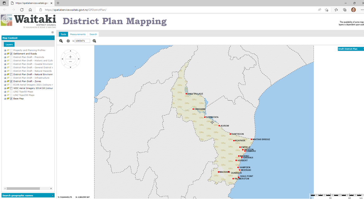
When you start up the mapping this is what you see to begin with:
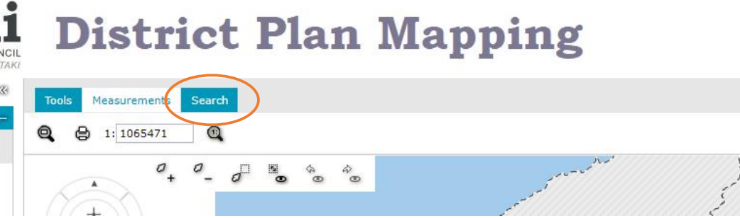
Click on the ‘Search’ tab:
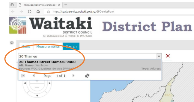
Type in your address into the box that appears below the ‘Search’ tab. As an alternative to an address, you can also use your legal description. Select your address when it comes up and the mapping will take you to your property.
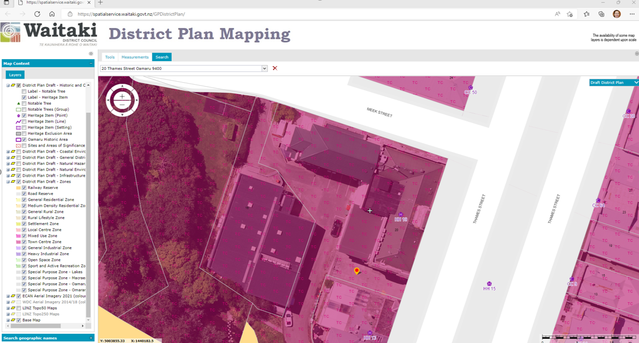
You can use the +/- button in the top left corner of the map to zoom in or out as required. The mapping shows the zones, and in the example below, the zoning is TC, which stands for Town Centre.
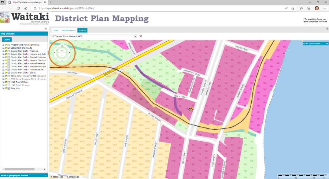
You can turn on and off other layers in the left-hand column to display any other overlays that may be mapped on the property.
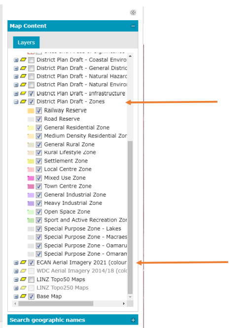
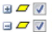
You can expand any of these layers with the + box and contract them by clicking again on the – box.
You can also turn on aerial imagery to help orientate yourself – find this under ‘ECan Aerial Imagery 2021’ in the legend.
Double clicking on the property will bring up relevant mapping information specific to that property:
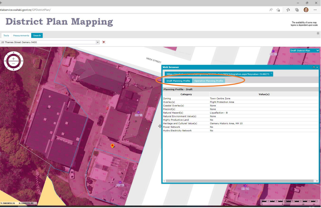
You can then compare the Draft Plan zone and overlays provided in the Draft Planning Profile for the property against the Operative Planning Profile by swapping between the two tabs (shown above).
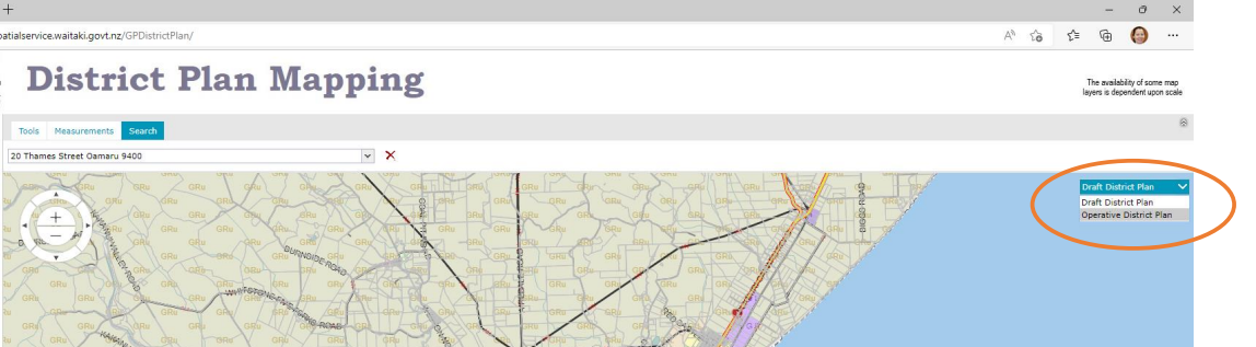
You can also swap between the Draft District Plan and Operative District Plan mapping by clicking on the arrow in the drop-down box in the top right-hand corner of the page.
Help and assistance
If you need any assistance using the Draft District Plan mapping, we have a dedicated space in Ōamaru on Steward Street (down the side of the Waitaki Museum – look for the signs). This drop-in space will have people on hand to help you 2 days a week from 10am-4.30pm. Check out the calendar on our website for dates.
Alternatively, we will have paper copies of the Draft District Plan maps available in several locations, including Council HQ, Ōamaru Library, Palmerston Service Centre and in several locations up the Waitaki Valley including the Kurow Museum and Information Centre and the Community Library in Omarama.
How to give your feedback
You can use the link on the District Plan Mapping page to go straight to our Have your say page to provide any feedback you might have on the draft District Plan mapping.